
Strava mapping tip
Posted July 21, 2015 05:17PM by
Skye in the
Cycling Forum
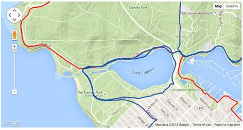
When I'm creating a segment on Strava, I like to get the start and end points as accurate as possible. However, I was finding you can only zoom in so far on the map until I discovered this trick. Here's the max zoom by default, which is really coarse:

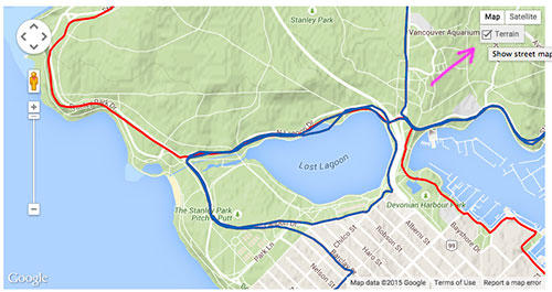
For more precision, go up to the Map menu, and uncheck the Terrain option:

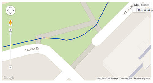
Now you're using the plain street map and you can zoom in super close to get those segment markers in just the right spot!

For more precision, go up to the Map menu, and uncheck the Terrain option:
Now you're using the plain street map and you can zoom in super close to get those segment markers in just the right spot!
Webmaster - Staminist.com